Upper West side had 8.3 inches, Central Park as of 7 am 7.8 inches, the Bronx 9.9 inches, LGA had 11 inches to the east on Long Island Massapequa 14.2 inches, Islip 20.9 inches. Orient 28.5 inches and Mattituck 24.8 inches. It was still snowing all these locations so final amounts will rise at that time.
Further north and east it has been as promised quite a snowstorm. I have been up since maybe 4:30am with S+ and as near to zero visibility as I can remember in quite a while (50 yards). After easing off a bit (but still less than 1/4 mile, it is back to 1/8 or less as I write this.
We will see 36 inches+ in central New England. Worcester reported 25 inches this morning.


The HRRR 3km model from 12Z adds 17 inches to the close to 18 inches so far here and near a foot in Worcester.

The jackpot was supposed to be NYC and southeast New England. Eastern Long Island and central New England though were ground zero targets with the storm center developing maybe 100 miles east of forecast.
See the snow still flying at 18Z.

)
This is the most in a single storm I have seen here in my 30 years.
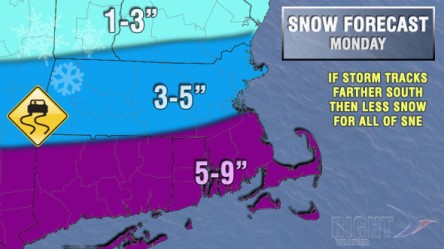
kind of like the GEM on what follows. The EC is an outlier with the storm next week among its ensemble members, many of which have strong arctic high pressure where the op run has a storm moving through southern New England. I think the storm is real but will track south and be a snow for DC, PHl, NYC.
It is followed by frigid air and at the end of the next week another storm likely snow for the northeast followed by more even colder affecting the central and then the east. Chicago will see sub zero cold and that air masss if as shown would threaten Florida.
.png)


.png)


.png)